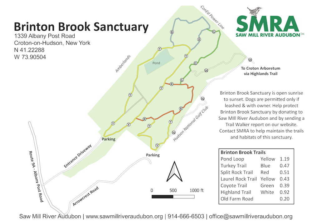
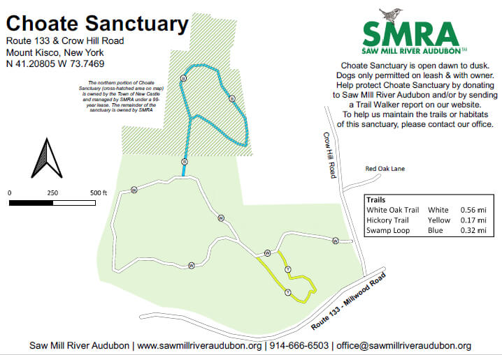
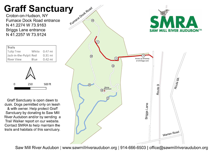
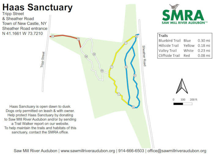
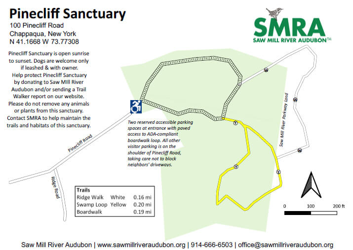
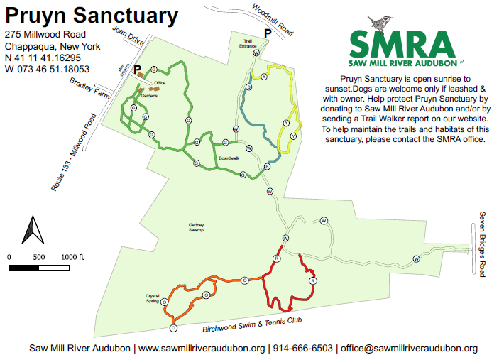
Visit Saw Mill River Audubon’s Avenza map store for free map downloads to use with the Avenza mapping app, or download individual georeferenced PDFs of trail maps on this web page.
These georeferenced maps can be imported into mapping apps on smart devices to use while hiking. When using these maps with Avenza or another mapping app, your exact location in the sanctuary will be shown on the map screen as you hike.
Have you enjoyed visiting our sanctuaries? Or perhaps you appreciate how our sanctuaries protect wildlife habitat, offer walking trails, improve water and air quality, and add to the beauty of our communities?
Consider supporting our local work with a donation.

